Best World Maps for Kindergarten: Engaging Tools to Spark Geography Curiosity
Finding kid-friendly world maps that keep young learners engaged can transform geography from a lesson into an adventure. The following selections emphasize durability, vivid visuals, and interactive learning to suit kindergarten classrooms and homes. Each option supports early geography, culture awareness, and critical thinking through age-appropriate design and hands-on activities.
| Product | Key Benefit |
|---|---|
| Teacher Created Resources World Map Learning Mat | Durable, write-on/wipe-off mats for repeat practice |
| Best Learning i-Poster My World | Interactive, voice-guided learning through country facts |
| Momo & Nashi United States Map For Kids & World Maps For Kids | Vibrant, updated designs ideal for wall displays |
| Melissa & Doug World Map Jumbo Jigsaw Floor Puzzle | Hands-on puzzle exploring continents and oceans |
| Swiftmaps World Premier Wall Map Poster Mural | Large, 3D-toned relief for visual geography |
Teacher Created Resources World Map Learning Mat

These durable, write-on/wipe-off mats offer ongoing learning possibilities in spelling, math, time-telling, and geography. Students can personalize their mats and then wipe clean to reinforce concepts. The mats are suitable for at-home use, meal-time activities, or travel. Use with compatible write-on/wipe-off crayons to create custom maps. This advanced learning tool emphasizes quick geography recognition and hands-on practice for ages 8 and up.
BEST LEARNING i-Poster My World
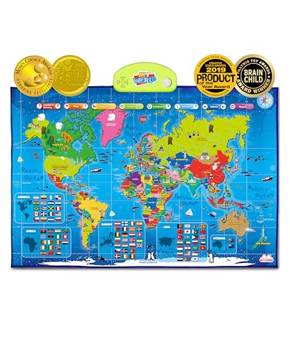
My World is an interactive world map for kids ages 5-12. Tap a country to hear its name, capital, and more than 500 voice-guided questions. The device is an award-winning educational toy that encourages STEM learning and world curiosity. It helps children learn about continents, oceans, landmarks, and flags through engaging, hands-on exploration and narrated feedback.
Momo & Nashi United States Map For Kids & World Maps For Kids
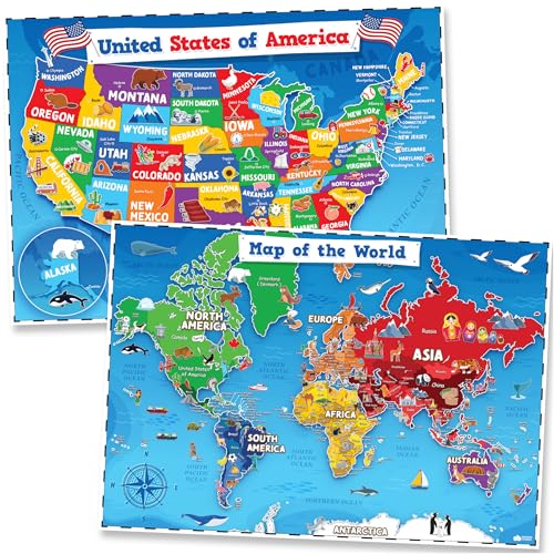
This 2-piece set includes United States and world maps designed for classrooms and home learning. The posters showcase updated content with bright, kid-friendly illustrations and icons. They are designed to inspire curiosity about different regions and cultures, making them versatile for wall displays in classrooms, bedrooms, daycare centers, and homeschool spaces.
Melissa & Doug World Map Jumbo Jigsaw Floor Puzzle

This 33-piece floor puzzle measures 2 by 3 feet when complete, providing a large, interactive way to learn continents and oceans. It helps develop hand-eye coordination, problem-solving, and geography knowledge as children fit pieces together to form the world map. The jumbo format supports group play and classroom activities.
Swiftmaps World Premier Wall Map Poster Mural

The World Premier wall map offers a large, immersive view of global geography. It features a folded edition for portability and a 3D shaded relief to highlight landmasses and oceans. This map supports classroom wall displays or family learning spaces, providing a clear, visual reference for young students exploring continents, oceans, and key regions.
Buying Guide
- Age suitability: Choose maps and activities that align with early learners’ developmental stages, typically ages 4–7 or 5–9 for more interactive tools.
- Engagement style: Decide between hands-on puzzles, interactive digital prompts, or durable write-on/wipe-off mats to match classroom routines and home practice.
- Durability and materials: Prioritize laminate, sturdy mats, or thick posters to withstand frequent use by young children and potential spills.
- Size and display: Large formats are beneficial for group activities and wall displays, while smaller mats support table-based work or travel use.
- Comprehensiveness: Consider whether the product covers continents, oceans, country names, capitals, and landmarks to build a broad geographic foundation.
- Interactivity: Interactive tools like voice-guided responses or clickable features can enhance retention, but ensure compatibility with existing classroom tech or devices.
- Multifunctionality: Items that double as decor (colorful posters) or that support multiple subjects (maps plus science themes) provide added value for classrooms and homes.
- Placement considerations: Wall posters suit classrooms and study corners, while floor puzzles work well for group play and大型家庭活动.