Best Map Images for Kids to Learn Geography at Home
Geography helps kids understand the world, spark curiosity, and build crucial map-reading skills. The following curated map-themed products are designed for classrooms, homeschool spaces, and kids’ rooms, combining bright visuals with engaging activities. This guide highlights five options that balance accuracy, readability, durability, and interactive learning.
| Product | Brand | What It Offers |
|---|---|---|
| Momo & Nashi United States Map For Kids & World Maps For Kids 2pc Set | Momo & Nashi | Two 24” x 16” posters with updated USA and world maps, vibrant visuals, kid-friendly icons, classroom-ready durability |
| BEST LEARNING i-Poster My World | BEST LEARNING | Interactive talking world map with 500 voice-guided questions; celebrates landmarks, oceans, continents, and cultures |
| USA Wall Map for Kids with Illustrations | Lighthouse Geographics | 18” x 29” laminated map; state borders, parks, cities, rivers, and cultural landmarks |
| Rand McNally Kids’ Illustrated World Wall Map | Rand McNally | Color-coded continents; native flora and fauna, landmarks, and labeled capitals and cities |
| Imagimake Mapology World Map Puzzle | Imagimake | World puzzle with flags and capitals; 75 country pieces plus a Europe map for expanded learning |
Momo & Nashi United States Map For Kids & World Maps For Kids
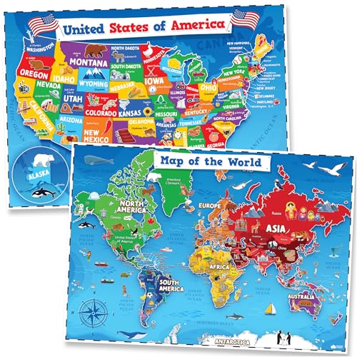
The two-poster set includes a United States map and a world map designed for younger learners. Features emphasize updated facts, engaging icons, and culturally diverse content to inspire discussions about regions, states, and countries. The bright, clear typography supports early readers, and the artwork is suited for classrooms, homes, and homeschool spaces. These maps are described as durable classroom posters that help create an inviting geography learning environment.
BEST LEARNING i-Poster My World
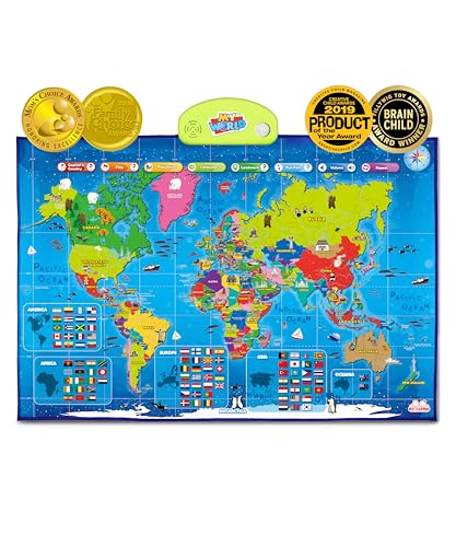
This interactive world map invites kids ages 5-12 to tap any country and hear its name, capital, and other fun facts through more than 500 voice-guided questions. It has earned family-friendly and child-focused awards, signaling its suitability for STEM-oriented learning and global curiosity. The map covers continents, oceans, landmarks, and flags, helping learners build geographic literacy through interactive play rather than passive viewing.
USA Wall Map for Kids with Illustrations

This laminated 18” x 29” United States map combines vivid colors with detailed illustrations of states, parks, cities, rivers, and regional cultural highlights. The durable build makes it well-suited for frequent classroom use or home learning corners. Its versatility supports both decor and education, providing a focal point for geography lessons and travel planning discussions.
Rand McNally Kids’ Illustrated World Wall Map

The Rand McNally world map emphasizes color-coded continents with lively illustrations of flora, fauna, landmarks, and cultural icons. It includes labeled capitals, major cities, and bodies of water for reference. Printed on sturdy paper, this map is designed to endure classroom usage and can serve as an engaging long-term geography reference in homes or libraries.
Imagimake Mapology World Map Puzzle

This puzzle-based map features country pieces, flags, and a Europe map to deepen geographic knowledge. It’s designed to support hands-on learning and spatial understanding, making it an appealing option for kids who learn best through tactile play. The product emphasizes easy assembly and clear labeling to promote independent exploration and collaborative geography activities.
Buying Guide
- Age suitability: Choose maps and activities aligned with your child’s reading level and curiosity. Interactive options like the i-Poster suit ages 5-12, while laminated wall maps work well for younger learners and early readers.
- Durability and durability features: For busy classrooms or homeschooling spaces, laminated surfaces and thick posters resist wear. Puzzle-based products add a tactile dimension but should have durable components for repeated use.
- Interactivity vs. passive viewing: Interactive maps encourage engagement through questions, sounds, or activities, while traditional posters support visual reference and long-term decor.
- Content breadth: If you want global context, include world maps with flags and capitals. For U.S.-centric learning, include state-level visuals and landmarks. A mix provides a balanced geography education.
- Visual clarity: Look for large fonts, high-contrast colors, and legible labels to support early readers and reduce cognitive load.
- Educational value: Favor products with culturally diverse content and accurate geographic details. Consider companion features like landmark illustrations, regional info, and supporting questions or activities.
- Maintenance and setup: Laminated posters are easy to wipe clean; decals and wall stickers offer flexible placement. Puzzles require space but add hands-on practice with geography.
- Storage and display: Ensure there is adequate wall space for posters or a dedicated area for the puzzle maps. Consider frames or mounting options to keep materials organized.
- Budget and scalability: Start with a core set (a world map and a U.S. map) and expand with a puzzle or interactive tool as interest grows. Look for bundles that provide complementary content.
These selections cover a range of formats—from large wall posters to interactive maps and engaging puzzles—allowing educators and parents to tailor geography learning to their child’s preferences while building a durable, educational learning space.